| Previous Unloads: | ||
|
1991 May: A Visit to Langkawi, the Land of Mahsuri 1991 Aug: Study tour to Medan, Indonesia 1994 May: First Asia Pacific Chitin and Chitosan Symposium (APCCS) 1995 Dec: Revisiting SAS 1997 Dec: Rally Nationwide Vision 1998 Apr MOU and Launching of Chito-Chem (M) Sdn Bhd 1999 Sep: The Officiation of Smart Technology Centre, UKM 1999 Sep 23: A Week on Leave 1999 Dec: Study Tour to Taiwan |
2000 Jul: A MiniReunion of Class of 66 2000 Dec: Just An Unlucky Day 2001 Jul: 29th Covocation of UKM 2001 Dec: Digging Deep Into the Root: SKBT Revisited 2002 Sep: A Consequential Events from Feb 2002 2003 Apr: Reminiscing the Little Boy 2003 Nov: Reunion of Class of 66 2004 May: Cameron Highland Revisited 2004 Jul: In the Heart of Two Cities 2005 Jan: SAS Re-revisited |
2005 Jan: Seri Puteri Eventually Visited 2005 Apr: In the Backyard (and Frontyard) 2005 Nov: Jalan Hale Revisited 2006 May: Kenyir, Here I Come 2006 Jun: Bidong Revisited 2006 Aug: Convocation UKM #34 2006 2006 Oct: The Faces of Ramadan 2007 Mar: Duku - The Fruit of Terengganu 2007 Nov: Ke Tepian Sang Seluang Melaut 2008 Apr: Drifted from the Past 2008 May: An Old Man and the Sea 2008 Jun: Bukit Besar - The Last Bastion |
Bukit Besar - The Last Bastion of Kuala Terengganu (Dated: 2008 Jun 20)
  |
| Bukit Besar viewed by the home-coming sea-goers, and by the approaching motorists on the Duyung Bridge. |
Development set in Kuala Terengganu. All the padi fields were developed. And were filled with the corporate buildings and government buildings. The eastern side was full. The court complexes, The Clinic, Fire Brigate, JPJ, wisma MAIDAM, Terengganu Trade Centre, Public Library, Hypermarket Mydin and Giants.
   |
Viewing from the distant, a "signal light" on its chest (ca. one-third of its height) is visible from the northern and eastern sides. And the communication antennas on the peak from every side. The latter is "insignificant". But the former is very significant. One has to be a fisherman to find out its secret. And find it out at night. The red "PELIHARAKANLAH TERENGGANU" is switched-on twelve hours a day from 7 pm to 7 am. It is visible as far as Redang Island, even when it rains. It is the pilot light for the returning fishermen at night. The fishermen need only to stear the boat toward the light to reach the Terengganu river mouth. Near the mouth the fishermen then are helped by the light house on the beach of Seberang Takir and on the land Bukit Losong. Of course that was during the days of pre GPS.
All other hills in Kuala Terengganu had conceded to the development. Bukit Tunggal, Bukit Datu, Bukit Losong, Bukit Kecil, Bukit Bayas, and Bukit Cendering. Bukit Puteri was saved nonetheless for it was guarding the Istana Maziah.
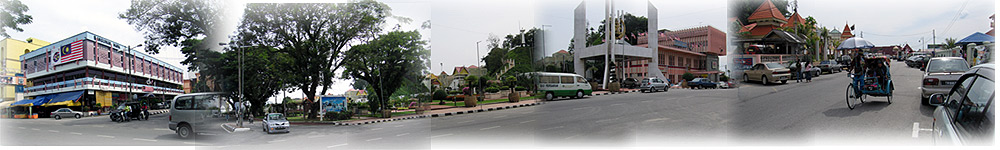 R-L: Bukit Puteri, Post Office, The gate to Istana Maziah, Padang Maziah and MARA Building. |
For the public, Bukit Besar offers a recreational corridor along its small steep windy road built long time ago to place the pilot light and the antennas. Ascending the hill is a good excercise. A streneous short distance walk.
 Ample parking outside the Wisma MAIDAM. Commecing the walk to accend Bukit Besar. |
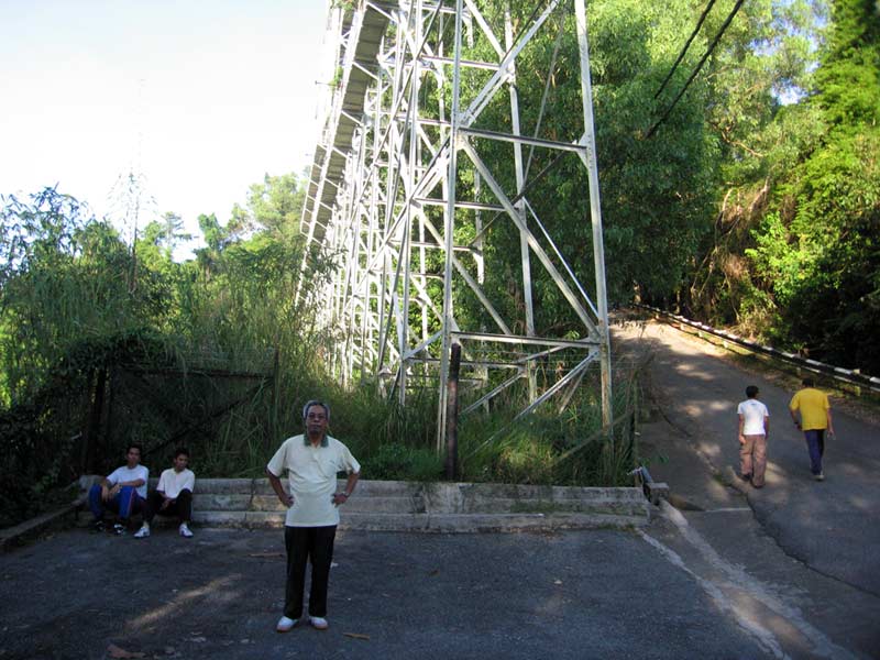 A close look at the "pilot light" seen on the chest of the hill. It was on a very sturdy rig, very accessible to maintenance. The platform was good for the first "break", about a third of the climb. |
 Viewing from behind the rig towards the sea. Bidong is clearly visible, Redang is hidden behind the rig bar. Reversibly thus, for viewers from both places. Viewing from behind the rig towards the sea. Bidong is clearly visible, Redang is hidden behind the rig bar. Reversibly thus, for viewers from both places. And the western view, covering the Wakaf Beruas to Pasir Panjang to Gong Tok Nasik. And beyond. |
 Windy road. Army landrover, and a TM 4-WD were seen decending and accending. |
 Finally the peak. I did it in 15-20 minutes. Ascending was tiring. But decending was dangerous. Apparently to slow down is more tiring and dangerous than to proceed. |